It was a moment I'll never forget: dawn in the Wasatch Mountains, the thermometer just above freezing, fog hanging over the aspen forests. Beneath me the Suzuki V-Strom 800DE, and on it a fresh set of Dunlop Trailmax Raid tires. As the first gravel kilometers of the Liberty-Avon Road crunched under the knobs, I knew: this test would be no laboratory exercise, but a baptism by fire in the raw reality of the American West.
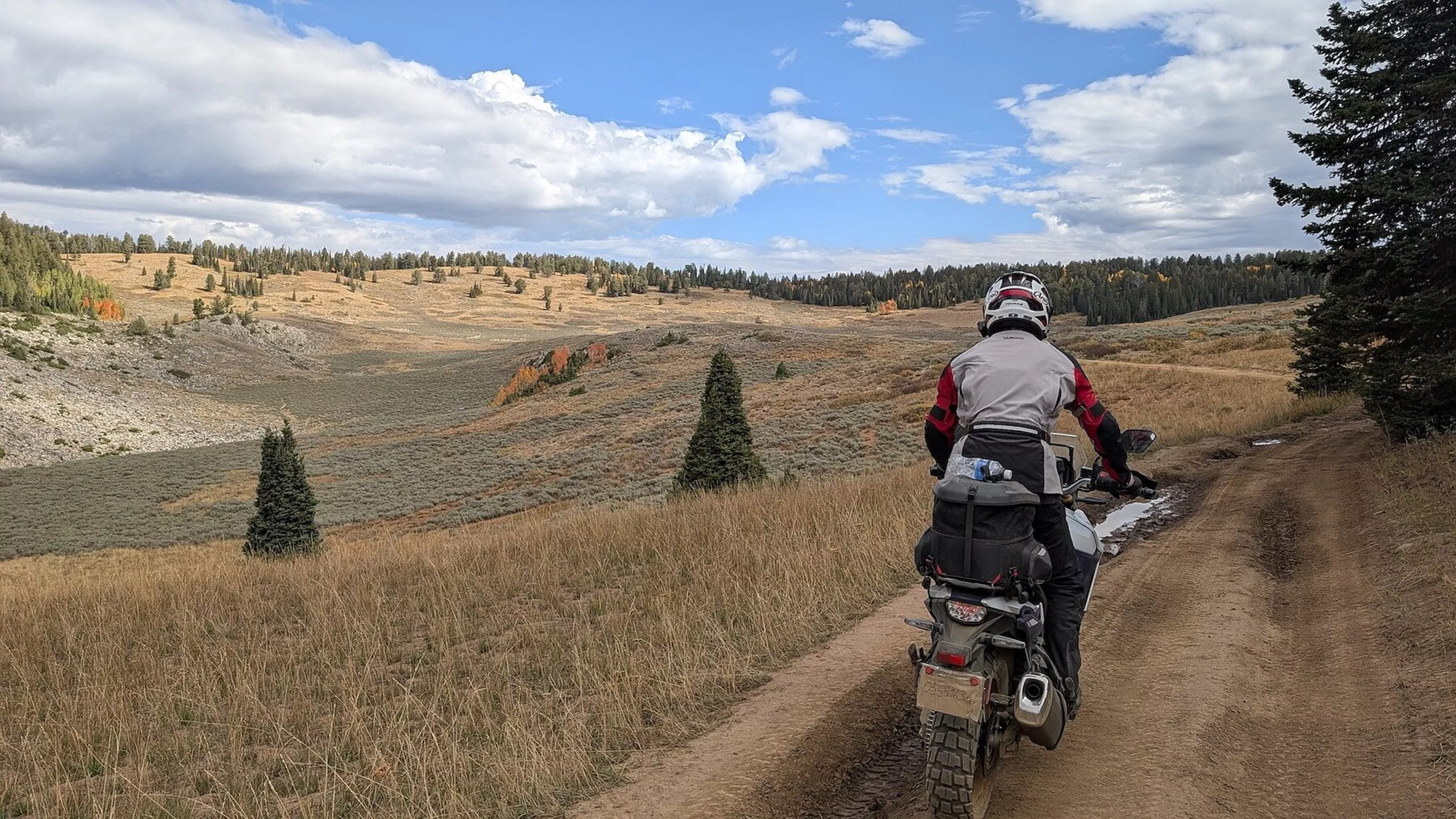
Dunlop Trailmax Raid tested on the Suzuki V-Strom 800DE
Adventure tire for road and gravel
Thousands of kilometers through Utah, Idaho, Wyoming, and Montana: the Dunlop Trailmax Raid proved itself in testing as a true 50/50 talent. Whether gravel roads, rain, or highways – it delivered on its promises.
&width=72&height=72&bgcolor=rgba_39_42_44_0&mode=crop "Author: nastynils")
nastynils
published on 13/10/2025
18,116 Views
Technical concept – not a compromise, but balance
Adventure tires often try to unite two contradictory worlds: road stability and off-road traction. Far too often, the result feels like a lazy compromise. With the Trailmax Raid, that's different. Dunlop consistently pursues the 50/50 philosophy – a balanced concept for road and off-road. The foundation for this is a Hi-Silica compound for excellent wet grip, JLB construction in the radial versions for stability and heat management, plus the Carcass Tension Control System, which optimizes contact patch behavior.
The character of the tire – traction on gravel, calm on asphalt
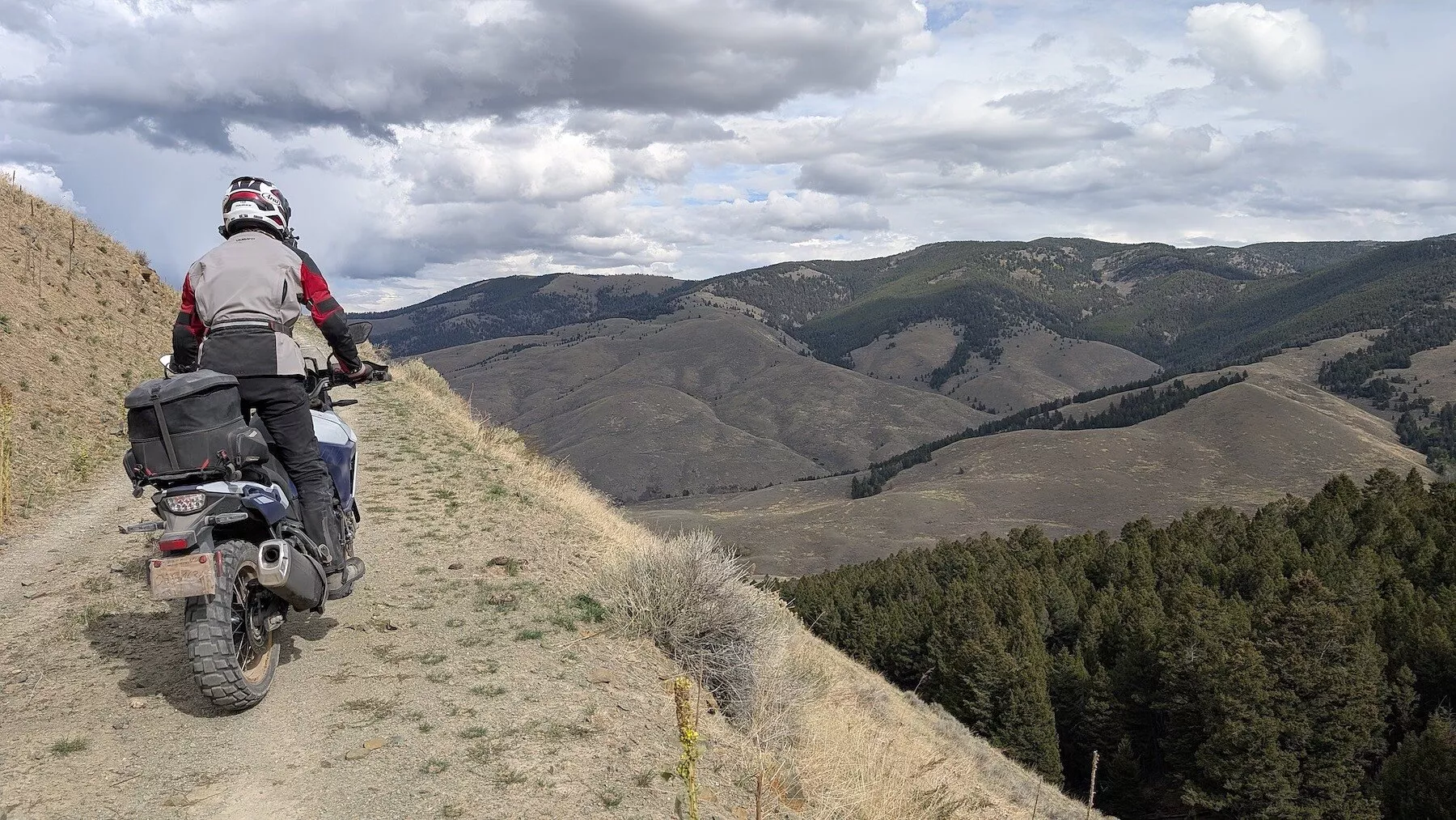
On the gravel roads of Idaho, the Trailmax Raid showed what it's made of. Even on damp, rocky ground it kept the V-Strom tracking with a composure that kept surprising me. Steep ramps, deep gravel, fast gravel highways at 70 mph – it mastered all of it with traction that inspired confidence. At the same time, a different side revealed itself on the highways of Wyoming: smooth running, stability, and a vibration level that remained surprisingly subdued for a 50/50 tire.
Everyday life on highways and interstates
Anyone familiar with adventure tires knows the typical hum and impulses that become noticeable at 120 km/h or more. The Trailmax Raid isn't entirely immune to this either, but it always stays within reasonable bounds. After hours on the interstate I didn't feel worn out, but rather carried along by a harmonious rolling behavior. Even during short rain showers in Yellowstone Park, grip on wet pavement remained reliable at all times – a point where many adventure tires falter.
The technology in detail – DFF and rally DNA
I found the Dynamic Front Formula, which Dunlop developed for the front wheel, particularly exciting. It ensures that the V-Strom turns in neutrally and doesn't wallow even in long, sweeping high-speed corners. The tread pattern itself, with its aggressive blocks, strongly recalls the D908 RR rally tire, though with a more everyday-friendly design. This results in the mix of rally flair and touring capability that makes the Trailmax Raid something special.
Limits off-road – honest 50/50 orientation
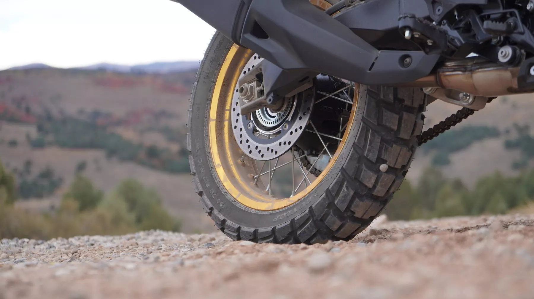
Of course, there are limits. In deep mud or muddy forest passages, the Trailmax Raid quickly reaches its limitations. For realistic adventure scenarios, from gravel roads in the Alps to gravel tracks in the American West, its off-road capability is entirely sufficient. When you put the Trailmax Raid into context, you automatically end up with the usual suspects: the Continental TKC 70 Rocks, the Michelin Anakee Wild, the Metzeler Karoo 4, and the Bridgestone AX41. All of them compete in the space between asphalt and off-road.
Everyday usability and tread life
An adventure tire has to be capable of more than just spectacular test rides. After 2,700 kilometers in the saddle, the Trailmax Raid showed hardly any noticeable wear. User reports confirm tread life between 6,000 and 8,000 kilometers – depending on load and riding style. For a tire with such a pronounced tread pattern, that's remarkable. And in everyday use too, whether commuting or on weekend rides, it convinces with predictable behavior and good grip in the wet.
The Trailmax Raid is available in nine dimensions, from 90/90-21 up front to 170/60R17 at the rear. All sizes carry the M+S marking, and the rubber compound is based on a high silica content, flanked by aramid or steel reinforcements for stability at high speed. This allows it to cover the entire adventure spectrum, from mid-size enduros to the big GS or Africa Twin calibers.
Front:
- 90/90-21 54T TL
- 110/80R19 59T TL
- 120/70R19 60T TL
Rear:
- 130/80-17 65S TL
- 140/80-17 69S TL
- 150/70R17 69T TL
- 170/60R17 72T TL
- 140/80-18 70S TL
- 150/70R18 70T TL
Points of criticism
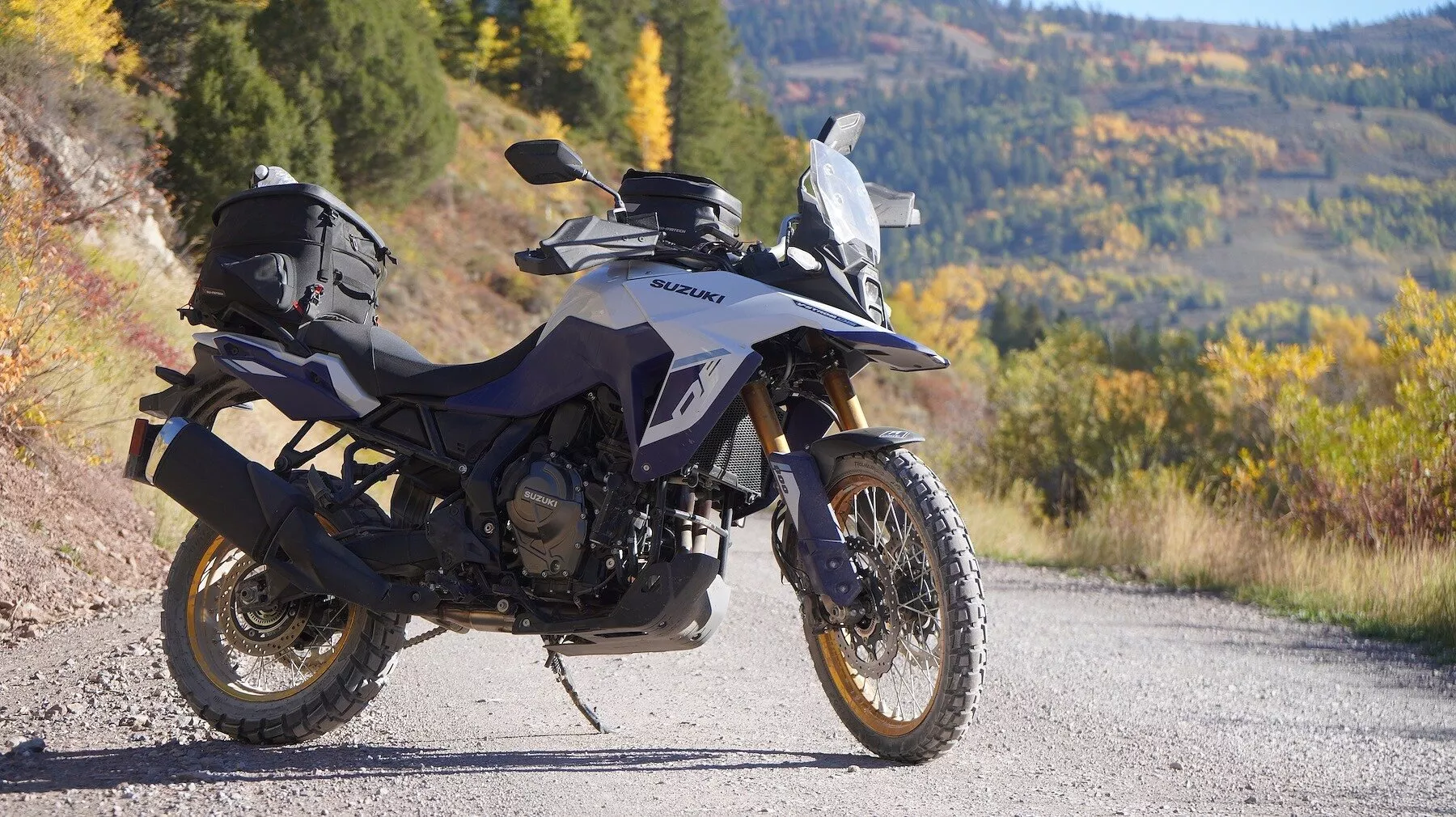
No tire is perfect – and the Trailmax Raid is no exception. Typical character traits of 50/50 tires were noticeable:
- When braking at lean angle, a slight righting moment showed up.
- On asphalt with tram grooves, it followed them a bit more willingly than road-oriented OEM tires.
- In extreme mud, it hits its limits as expected.
However, these points are not weaknesses in the classic sense, but part of the design and must be accepted with a tire of this category.
The test environment – where tires reveal their true nature
Testing a tire to its core takes more than a few Sunday rides. Our route through Utah, Idaho, Wyoming, and Montana delivered exactly the spectrum that pushes a 50/50 tire to its limits: 2,700 kilometers through four states, roughly 80 percent of it on unpaved roads. In the morning, ice crystals on the seat at one degree Celsius; by midday, 30 degrees through bone-dry sagebrush valleys. Elevation changes between 800 and 2,700 meters, where the thin air takes its toll not only on the engine but on the rubber compound as well. Fast gravel highways through the Caribou-Targhee National Forest, where we thundered over washboard tracks at 70 mph. Steep gravel ramps at Lemhi Pass, washed-out forest roads to Stanley, rocky singletrails near Island Park. In between, always more asphalt sections – sometimes dry and hot, sometimes wet after brief thunderstorms in Yellowstone. And over it all, the merciless reality of long travel days: six, seven hours in the saddle, fully loaded, without mercy. If a tire fails here, there's no plan B. The nearest dealer is hundreds of kilometers away, and the wilderness tolerates no weakness. It's exactly in this environment that it becomes clear whether a tire is a marketing promise or a genuine tool.
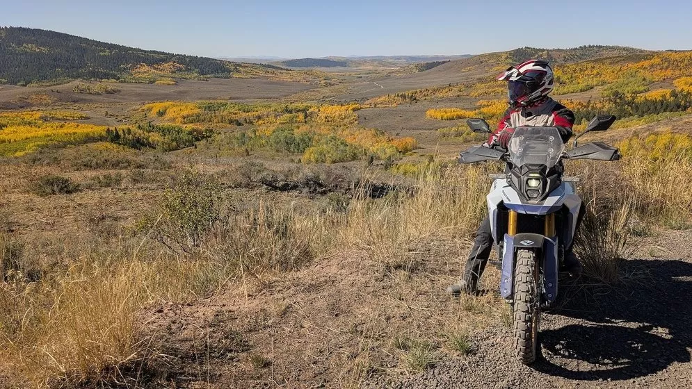
After 2,700 kilometers across gravel, highways, and national parks, my conclusion is clear: the Dunlop Trailmax Raid is no compromise tire, but a genuine adventurer. It combines the calmness of the road with forward drive off-road, and consistently conveys a sense of control and reliability. Anyone wanting to dive into both worlds with their adventure touring bike will find a partner here that masters this balancing act with confidence.
Yellowstone Trip 2025
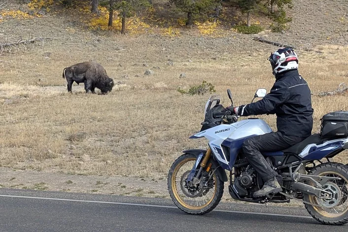
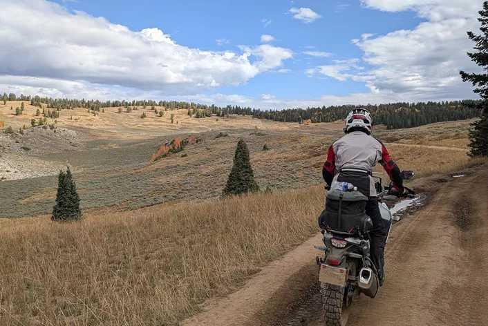
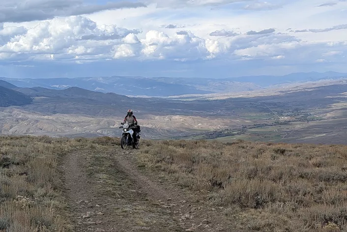
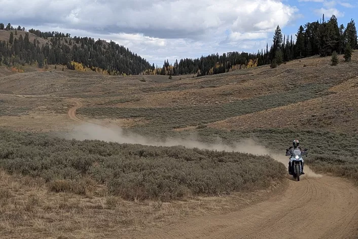
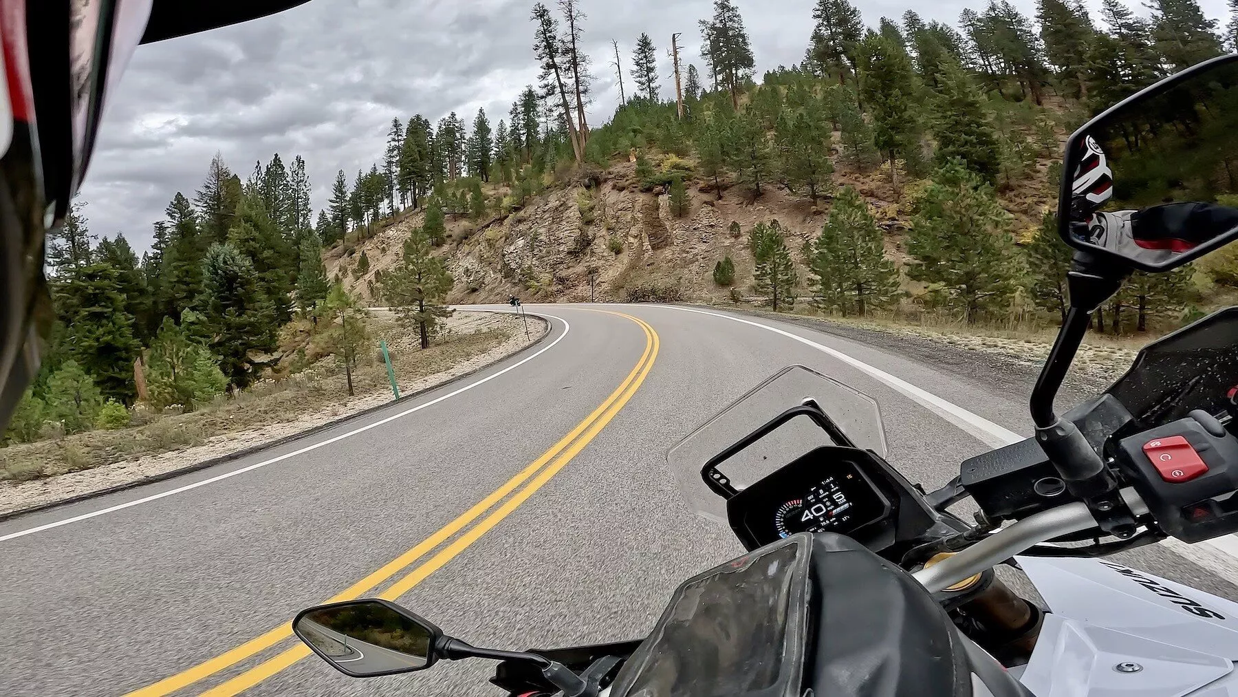
Had to deliver on asphalt too - Dunlop Trailmax Raid on the trip to Yellowstone National Park
Conclusion: Dunlop Trailmax Raid on tour - tested
The Dunlop Trailmax Raid runs quietly on the road and delivers clean forward drive off-road. Across gravel, highways, and national parks, it consistently conveys control and reliability without faltering on either side. For adventure touring riders who regularly switch between asphalt and gravel, it's a strong choice, as it serves both worlds without any noticeable compromise.
Dunlop Trailmax Raid tested on the Suzuki V-Strom 800DE Images
Source: 1000PS

Our top pick! After careful consideration, we decided to tackle this intense journey on 2 V-Stroms.

Next decision: gear! We're going to hit some wildly different temperature zones. On the flip side, the enduro sections can be quite demanding. So, I opted out of a too-cool off-road outfit and went for a touring suit from Vanucci. But without a rigid membrane in the jacket!

Decision number 3: The tire! We went with the Dunlop Trailmax Raid!

We're picking up our two Suzuki V-Strom 800DE bikes at "Edge Powersports" near Salt Lake City. General Manager Randy Hall shares some route tips for our first local ride to Park City. Randy usually doesn't offer rental bikes, but he’s always a pit stop for riders crossing the North American continent. <a href="https://www.get2theedge.com" title="https://www.get2theedge.com" target="_blank">https://www.get2theedge.com</a>

Golden aspens, yellow hills, endless curves – the first day through the Wasatch Mountains showcased Utah at its finest.

A day among mountain panoramas, eagles in the sky, and the first dust under the knobs – the perfect kick-off to the adventure.

Kickstarting our journey in Salt Lake City – just a few miles in, we were enveloped by the vibrant yellow autumn sea of the Wasatch Mountains. <a href="https://maps.app.goo.gl/DGmMWfMUqQBGAPNT7?g_st=ipc" title="https://maps.app.goo.gl/DGmMWfMUqQBGAPNT7?g_st=ipc" target="_blank">https://maps.app.goo.gl/DGmMWfMUqQBGAPNT7?g_st=ipc</a>

Park City welcomed us with Olympic vibes and autumn colors before the V-Stroms racked up their first gravel miles on Liberty-Avon Road.

Park City hosted the 2002 Winter Olympics – to this day, the town breathes sporting history.

Park City: Where gold miners once toiled, today adventure bikes roar down Main Street with Olympic vibes. The Olympic Museum showcases original racing suits, medals, and spectacular photos from bobsled and ski jumping competitions.

Unbelievable: Before the games, Park City was a quiet mountain town – the Olympics turned it into an international sports metropolis.

Parked right outside the lodge – the Suzuki V-Strom 800DE is patiently waiting for the next gravel adventure. <a href="https://maps.app.goo.gl/fnC6VibvnMk6T8fS6?g_st=ipc" title="https://maps.app.goo.gl/fnC6VibvnMk6T8fS6?g_st=ipc" target="_blank">https://maps.app.goo.gl/fnC6VibvnMk6T8fS6?g_st=ipc</a>

On days like this, we really missed a feature on the V-Strom: heated grips!

The first dust, the first gravel, the first grin: Welcome to Adventure Mode USA. <a href="https://maps.app.goo.gl/2ZSnd1c1YuzmhWBw6?g_st=ipc" title="https://maps.app.goo.gl/2ZSnd1c1YuzmhWBw6?g_st=ipc" target="_blank">https://maps.app.goo.gl/2ZSnd1c1YuzmhWBw6?g_st=ipc</a>

An omelette for breakfast, then 300 kilometers of gravel – that's the taste of a true adventure day in the Wild West.

The Suzuki V-Strom 800DE devoured gravel miles like they were asphalt – confident, stable, and fuel-efficient.

At over 2,000 meters above sea level, the V-Strom barely loses power – a quiet, composed companion in the high mountains.

Endless gravel roads connected valleys, ranches, and mountains – official roads that felt like adventure trails.

Early start at 33°F – the seat was still frozen, the coffee hot, and the adventure in Wyoming begins. But the light was simply gorgeous in the early morning!


21-inch front wheel, 220 mm suspension travel – on gravel roads like this, the V-Strom proves that ruggedness and comfort go hand in hand.

The Suzuki V-Strom 800DE showcases how technical precision translates into confidence – 776 cc, 84 hp, and an engine that feels smoother with every mile.

230 kilograms ready to ride, yet surprisingly nimble – the extra weight feels like a boost in stability and durability.

The air freezes in your lungs, the sun bathes the mountains in gold – Wyoming welcomes us with silent power. <a href="https://maps.app.goo.gl/5xDSQpKmXXTrnN5C9?g_st=ipc" title="https://maps.app.goo.gl/5xDSQpKmXXTrnN5C9?g_st=ipc">https://maps.app.goo.gl/5xDSQpKmXXTrnN5C9?g_st=ipc</a>

Morning frost, midday in the mountains – the V-Strom handles all temperature zones and elevations with ease.


The Caribou-Targhee National Forest showcases the sheer diversity of nature – rivers, rocks, forests, desert

We had fantastic weather throughout our trip. However, for rides further north to the Canadian border, it's best to start 2-3 weeks earlier.

<a href="https://maps.app.goo.gl/DZb9UGZdVUx6fuLJ7?g_st=ipc" title="https://maps.app.goo.gl/DZb9UGZdVUx6fuLJ7?g_st=ipc" target="_blank">https://maps.app.goo.gl/DZb9UGZdVUx6fuLJ7?g_st=ipc</a>

Trails with legendary names reminded us of pioneers and explorers – and we rode right through their stories.

Dust in the air, sun on the helmets – the route took us for hours through open expanse.

The twin-cylinder runs so smoothly that you almost forget how demanding the road actually is.

Our ride spanned from September 26th to October 4th, 2025.

<a href="https://maps.app.goo.gl/kcLLLQFYnqnpu8F87?g_st=ipc" title="https://maps.app.goo.gl/kcLLLQFYnqnpu8F87?g_st=ipc" target="_blank">https://maps.app.goo.gl/kcLLLQFYnqnpu8F87?g_st=ipc</a>


Cows by the roadside, shots in traffic signs – the Wild West lives on in every little detail here.

The ranch gates were little masterpieces – from lovingly adorned to menacing with revolver turrets.


A river snakes through the valley like a silver ribbon – the V-Strom glides peacefully along the bank. <a href="https://maps.app.goo.gl/RK3xvAWaVRwaGMs37?g_st=ipc" title="https://maps.app.goo.gl/RK3xvAWaVRwaGMs37?g_st=ipc" target="_blank">https://maps.app.goo.gl/RK3xvAWaVRwaGMs37?g_st=ipc</a>


Conversations with the cowboys stick: honest folks, wide horizons, harsh winters.

The scent of dust, resin, and crisp mountain air – the blend that keeps adventure riders hooked

Fantastic autumn day! We're currently at about the same latitude as South Tyrol! <a href="https://maps.app.goo.gl/acX2UvYqaSn1wQGeA?g_st=ipc" title="https://maps.app.goo.gl/acX2UvYqaSn1wQGeA?g_st=ipc" target="_blank">https://maps.app.goo.gl/acX2UvYqaSn1wQGeA?g_st=ipc</a>

This time we're camping without a tent! But if you're crashing in the woods, don't forget to grab some bear spray at the outdoor shop!

Wyoming's population density is just 2 people per square kilometer. In Germany, it's a whopping 230.

The 4 states we've traveled through cover an area the size of Western Europe. Yet, they don't even have the population of Berlin!

The 800DE looks rugged, solid, and understated – built for those who prefer to ride rather than talk.

On this ride, it became clear: the longer the leg, the better the Suzuki feels.

Idaho Falls - Just a few miles separate dusty trails from a well-kept city!

The quickshifter works flawlessly in both directions – a small detail that brings immense joy on long rides.

With a fuel consumption of 4.5 liters per 100 kilometers, the V-Strom remains impressively economical – even on long off-road days.

Amid gravel, asphalt, and rocks, the character of the V-Strom remains constant – predictable, composed, and genuine.

Yellowstone is the oldest national park in the world – established on March 1, 1872.

Traction control is solid, but the engine is even better – sensitive enough to ride safely without electronics.

The first bison on the road – majestic, calm, and totally unfazed by two motorcycles.

Yellowstone is the oldest national park in the world – established on March 1, 1872.


Beneath Yellowstone lies an active supervolcano – its last eruption was around 640,000 years ago.


The state of Montana is roughly the size of Germany and Austria combined. Montana has a population of 1.1 million, while Germany and Austria together have about 90 million.


Steam rises from the ground – the breath of the earth, right in the heart of Yellowstone.

When you ride for days, you feel it: The ergonomics are spot on. Seat, handlebars, footpegs – everything works together for those long hauls.

About 60% of the world's geysers are found here – over 500 active springs.


The Yellowstone volcano causes 1,000 to 3,000 earthquakes each year.

The bison is grazing by the roadside, as if the park belongs to him – and in a way, it really does.

Around 4 million visitors each year – yet over 95% of the area remains true wilderness.

The park is home to around 5,000 bison, the largest free-ranging herd in North America.


The hot springs hit temperatures over 90 °C – often just inches beneath the boardwalk.

Yellowstone National Park is over twice the size of my home state of Burgenland!

Colors like a masterpiece: Sulfur yellow, turquoise, and rusty red around the hot springs.

Some hot springs are home to bacteria that can thrive at temperatures over 70 °C – known as thermophiles.

The colors of the hot springs come from microorganisms, not minerals.

A glimpse into the Caldera: 3,500 square miles of nature shaped by fire and time.

Over 500 active geysers – nowhere else on Earth does the ground unleash so much energy.

The scent of sulfur hangs in the air – the earth is alive, quaking, breathing.

Cruising the boardwalks – life is buzzing beneath us, while above us, it's pure tranquility.

The park is home to grizzly bears, wolves, moose, eagles, and coyotes.

Steaming valleys, rushing rivers, autumn forests – Yellowstone brings contrasts together.

Riding through geological history on two wheels – every mile tells a story of volcanoes and transformations.

The steel tube frame with a bolted rear end delivers what you truly need for long journeys: confidence.

We leave Yellowstone with dust on our boots and awe in our hearts – a place that sticks with you. The state of Montana spans 380,000 square kilometers. Germany and Austria combined add up to 404,000!

On our journey, we tackle the dusty trails across 4 states. <a href="https://maps.app.goo.gl/VJCYHfFJMvmydkvP9?g_st=ipc" title="https://maps.app.goo.gl/VJCYHfFJMvmydkvP9?g_st=ipc" target="_blank">https://maps.app.goo.gl/VJCYHfFJMvmydkvP9?g_st=ipc</a>


In the USA, there are over 1.5 million miles of unpaved roads – from desert trails to mountain routes

Today, we hit the roads in both Montana and Idaho.


Many gravel roads are official county roads, meaning they're regular, publicly accessible routes.

The road network still has roots from the Wild West era, when stagecoaches, cattle drives, and gold seekers blazed their own trails.

The western states of the USA have up to 80% public land, while Germany has only about 30%.

Many trails are relics from the 'Homestead Era', when settlers connected their farms via simple paths.

In national forests, hundreds of miles of legal dirt roads wind through untouched nature.

Trail maps are often sourced from the US Forest Service, BLM, or other agencies, digitally accessible via apps like OnX Offroad.

In states like Utah, Idaho, Montana, and Wyoming, much of the infrastructure runs on gravel roads.

The trail network is closely tied to forestry and ranch operations – access routes to pastures, woodlands, or mines are permanently maintained.

In Germany and Austria, almost every forest road is off-limits, as forest, environment, and private property take precedence.

The reason: low population density – paving the asphalt often doesn't pay off economically.

Many off-road trails run through land managed by the Bureau of Land Management (BLM) – open access for everyone. On BLM land, you can often camp, ride, and take photos freely – as long as you avoid leaving tracks.

Location: <a href="https://maps.app.goo.gl/vWENQKVLUu9cD4V96?g_st=ipc" title="https://maps.app.goo.gl/vWENQKVLUu9cD4V96?g_st=ipc" target="_blank">https://maps.app.goo.gl/vWENQKVLUu9cD4V96?g_st=ipc</a>

Location: <a href="https://maps.app.goo.gl/hDH828mPUda7AKTb6?g_st=ipc" title="https://maps.app.goo.gl/hDH828mPUda7AKTb6?g_st=ipc" target="_blank">https://maps.app.goo.gl/hDH828mPUda7AKTb6?g_st=ipc</a>


7,413 feet above sea level – the continental divide marks the symbolic high point of the day.

The landscape is rugged, solitary, and breathtaking – this is what discovery must have felt like.

In 1805, horses and pioneers struggled uphill – in 2025, the V-Strom effortlessly climbs with 84 hp and ease.

At Lemhi Pass: Once shattered dreams of a waterway to the Pacific – today, motorcycles roar over the divide.

Tracing historical paths – the Lewis and Clark route became the stage for our adventure touring bike today

The descent was steep, rugged, and wild – hard to believe that carriages once slid down here. Location: <a href="https://maps.app.goo.gl/ju7AmJDxPnCBfVjr8?g_st=ipc" title="https://maps.app.goo.gl/ju7AmJDxPnCBfVjr8?g_st=ipc" target="_blank">https://maps.app.goo.gl/ju7AmJDxPnCBfVjr8?g_st=ipc</a>

In the valley, we were greeted by a rain shower - yet somehow we narrowly dodged the downpours. It was incredible how regionally varied the rainfall was.

Today, we're tackling plenty of off-road miles. It rained last night...

39% of Idaho is forested

In Idaho, encounters with bears are a real but manageable risk of any outdoor adventure. Especially in the central and northern parts of the state – like the Salmon-Challis National Forest, the Bitterroot Mountains, or the Sawtooth Range – both black bears and a few grizzly bears roam. The latter are significantly rarer here than in neighboring Montana or Wyoming, but can still be found in remote areas. Most incidents occur when bears are surprised or find access to food. So, it’s essential to use bear-proof food containers, never store food scraps in your tent, and make noise in dense vegetation to alert the animals early. Carrying bear spray and maintaining a distance of at least 100 meters keeps the risk minimal. Those who act wisely can safely enjoy Idaho’s wilderness – and with a bit of luck, even catch a respectful glimpse of these impressive creatures.

Early morning! The V-Strom is ready to roll. Just grab some breakfast, and we’re off again!

We've been on the road for 5 days now, covering around 300 kilometers a day! Yet, I still feel fresh! The V-Strom delivers outstanding long-distance comfort!

Today, the plates for both Suzukis arrived. Until now, we've been rolling with makeshift cardboard tags.

Today, we’ll be cruising through ghost towns from the Gold Rush era. The road network is partly based on the routes originally laid out for gold transport. <a href="https://maps.app.goo.gl/CYjMKFqdfKRjNNGv6?g_st=ipc" title="https://maps.app.goo.gl/CYjMKFqdfKRjNNGv6?g_st=ipc" target="_blank">https://maps.app.goo.gl/CYjMKFqdfKRjNNGv6?g_st=ipc</a>

Many ghost towns sit at over 2,000 meters above sea level and are snowbound for months during winter.


Many places can only be accessed via rough gravel roads – perfect for adventure bikes exploring historical routes.

Even in remote areas, we always felt very welcome - though it's wise to follow the rules and show some good manners!

Amazing trails alongside the Salmon River: <a href="https://maps.app.goo.gl/cx5L5PybMJa2n86aA?g_st=ipc" title="https://maps.app.goo.gl/cx5L5PybMJa2n86aA?g_st=ipc" target="_blank">https://maps.app.goo.gl/cx5L5PybMJa2n86aA?g_st=ipc</a>


Clear rules - Which vehicles are allowed on this trail? <a href="https://maps.app.goo.gl/uHLVAdQrEQcYN1iA9?g_st=ipc" title="https://maps.app.goo.gl/uHLVAdQrEQcYN1iA9?g_st=ipc" target="_blank">https://maps.app.goo.gl/uHLVAdQrEQcYN1iA9?g_st=ipc</a>

Most ghost towns sprang up between 1860 and 1890, when Idaho became the hotspot for gold and silver mining.


Idaho boasts over 95,000 miles of unpaved roads – more than any other state in the USA.

Location: <a href="https://maps.app.goo.gl/AoGBn3TCeB1k94bV9?g_st=ipc" title="https://maps.app.goo.gl/AoGBn3TCeB1k94bV9?g_st=ipc" target="_blank">https://maps.app.goo.gl/AoGBn3TCeB1k94bV9?g_st=ipc</a>

Many of these trails were carved out during the Gold Rush around 1860 – today they lead to adventure, not gold.

Idaho is home to over 100 documented ghost towns, many dating back to the Gold Rush of the 19th century. Location Ghost Town "Custer, Idaho": <a href="https://maps.app.goo.gl/g9edzuNriDd4RFxi9?g_st=ipc" title="https://maps.app.goo.gl/g9edzuNriDd4RFxi9?g_st=ipc" target="_blank">https://maps.app.goo.gl/g9edzuNriDd4RFxi9?g_st=ipc</a>

The Salmon River, the 'River of No Return,' has carved deep into the rocks of the Rocky Mountains over millions of years. And today, the 'No Return' is about to become a sad reality for me...

These peaks are part of the Sawtooth Range, a segment of the Northern Rockies – young, rugged, and breathtaking.

Over 60% of Idaho is owned by the state or federal government – a land of freedom in the truest sense.

Stanley is one of the coldest spots in the U.S. with a population of just around 100 – winters can drop to -40 °C. We're only a few minutes away from our destination now. But first, I'm getting icy feet, and the cameraman is still chuckling. Just moments later, though, he finds himself wading into the frigid river to help me out!

Today’s leg takes us from Stanley to Boise. Between the Sawtooth Mountains and Boise Basin: 300 kilometers of variation – 80 percent gravel, dust, and pure riding joy.


Along Mores Creek, the route traces an ancient trade path – now a dream road for enduro riders.

Without traction control, casual drifts are possible. However, with the gravel mode engaged, the bike stays stable on course.

The Ponderosa Pine Scenic Byway is one of Idaho's most breathtaking motorcycle routes – twist after twist through dense pine forests.

Fuel stations are plentiful for adventure bikes. With hard enduros, we’d be in trouble. On some days, we needed ranges (including safety reserves) of about 150 - 200 kilometers.

Exciting trail with a rewarding destination. Heading to the hot pools! Location: <a href="https://maps.app.goo.gl/CY2cqsdpJwYpEfvj6?g_st=ipc" title="https://maps.app.goo.gl/CY2cqsdpJwYpEfvj6?g_st=ipc" target="_blank">https://maps.app.goo.gl/CY2cqsdpJwYpEfvj6?g_st=ipc</a>

Warm Springs Creek is a geological marvel: thermal water shoots straight out of the rock into a freezing mountain river. Soaking in the wild – the hot springs at Warm Springs Creek are natural pools nestled between rocks and rushing water. Location: <a href="https://maps.app.goo.gl/6FGq3hPxWWNRSNdC6?g_st=ipc" title="https://maps.app.goo.gl/6FGq3hPxWWNRSNdC6?g_st=ipc" target="_blank">https://maps.app.goo.gl/6FGq3hPxWWNRSNdC6?g_st=ipc</a>

Once again, we were blown away at the Hot Pools by Springs Creek. It's incredible how few people take advantage of such amazing natural experiences. Here in Idaho, there's vast wilderness and plenty of space for relatively few tourists.

You’ll often spot beachgoers by the roadside. The easily accessible swimming spots along well-paved roads aren't private. The secluded springs in the woods are, at least during the week, a truly exclusive treat. <a href="https://maps.app.goo.gl/phyUT1RY9AMssqZU6?g_st=ipc" title="https://maps.app.goo.gl/phyUT1RY9AMssqZU6?g_st=ipc" target="_blank">https://maps.app.goo.gl/phyUT1RY9AMssqZU6?g_st=ipc</a>

The Boise Mountains showcase ever-changing vegetation zones – from alpine coniferous forests to arid canyons. You can also spot signs of wildfires along the way.

For hours between Stanley and Boise, you won’t see a single town – pure solitude on two wheels. <a href="https://maps.app.goo.gl/xeXsEST5qcnkRLxv6?g_st=ipc" title="https://maps.app.goo.gl/xeXsEST5qcnkRLxv6?g_st=ipc" target="_blank">https://maps.app.goo.gl/xeXsEST5qcnkRLxv6?g_st=ipc</a>

Missing my pup at the stunning sandy riverbanks! My Goldendoodle would have a blast here—digging in the sand and splashing in the water. Total dream scenario.

After several hours, we reached a mountain hut. Here, snacks and drinks are available, as well as accommodations. <a href="https://maps.app.goo.gl/DojXYzHefkfKj5rk8?g_st=ipc" title="https://maps.app.goo.gl/DojXYzHefkfKj5rk8?g_st=ipc" target="_blank">https://maps.app.goo.gl/DojXYzHefkfKj5rk8?g_st=ipc</a>


The Arrowrock Reservoir once supplied water to Boise – today, the 60-meter-high dam is a stunning viewpoint. The historic Arrowrock Dam was the tallest dam in the world in 1915 – built right in the heart of Idaho's wilderness.

The Capitol Building in Boise, with its white dome, resembles Washington D.C. – a symbol of Idaho's independence in the heart of the Northwest.

Shoshone Falls are part of a massive irrigation system that turned southern Idaho into a fertile oasis – water as the lifeblood of the desert.

Deep basalt formations around the waterfalls – remnants of ancient volcanic eruptions in the Snake River Canyon.

The Snake River has carved this canyon over millions of years – a natural wonder in the arid south of Idaho. <a href="https://maps.google.com?ftid=0x54aca1b0eba07461:0x1d298d93ca046551&entry=gps&lucs=,94275415,94224825,94227247,94227248,94231188,94280564,47071704,47069508,94218641,94282134,94203019,47084304&g_st=ipc" title="https://maps.google.com?ftid=0x54aca1b0eba07461:0x1d298d93ca046551&entry=gps&lucs=,94275415,94224825,94227247,94227248,94231188,94280564,47071704,47069508,94218641,94282134,94203019,47084304&g_st=ipc" target="_blank">https://maps.google.com?ftid=0x54aca1b0eba07461:0x1d298d93ca046551&entry=gps&lucs=,94275415,94224825,94227247,94227248,94231188,94280564,47071704,47069508,94218641,94282134,94203019,47084304&g_st=ipc</a>

Shoshone Falls – also known as the 'Niagara of the West' – plunges over 65 meters, even higher than its famous namesake on the East Coast.

High above Salt Lake City, the view opens up over the vast valley – framed by the peaks of the Wasatch Range.

One last taste of the wild! Now it's time to clean the bikes, and tomorrow we head home from Salt Lake City!


